 Sunday,
September 20, 2015
Continuing the streak of climbing newly-opened mountains, after hearing from our Talamitam guide that Mt. Apayang was already open for hikers, my friends and I immediately set a date to climb it. After praying for the whole week for it not to rain, we were able to successfully conquer Talamitam’s neighbor. But this was no easy feat, because this mountain gave me the most stressful descent so far!
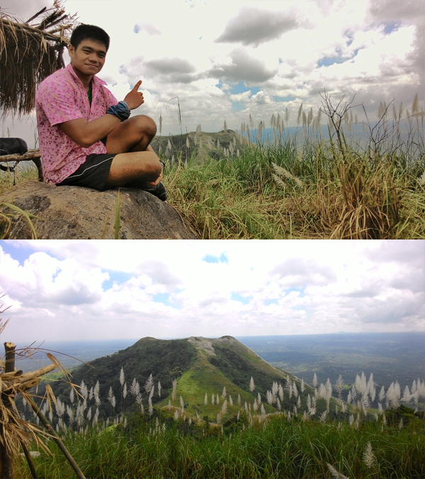
Mt. Apayang (or Apayap/Apayan) was opened last August 22-23, 2015. Its introductory climb saw more than 100 mountain climbers hiking up the trail in just one day. The summit of the mountain is said to be about 10 meters higher than the neighboring Mt. Talamitam.
Hikers can choose to traverse the two mountains or just climb up and down Apayang’s trail. They can also choose between going up Apayang first then traversing to Talamitam, or vice-versa. Because we were more familiar with the Talamitam jumpoff, we did the Talamitam-Apayang traverse.
Let me illustrate our climb in a simple graphic that’s easy to understand:
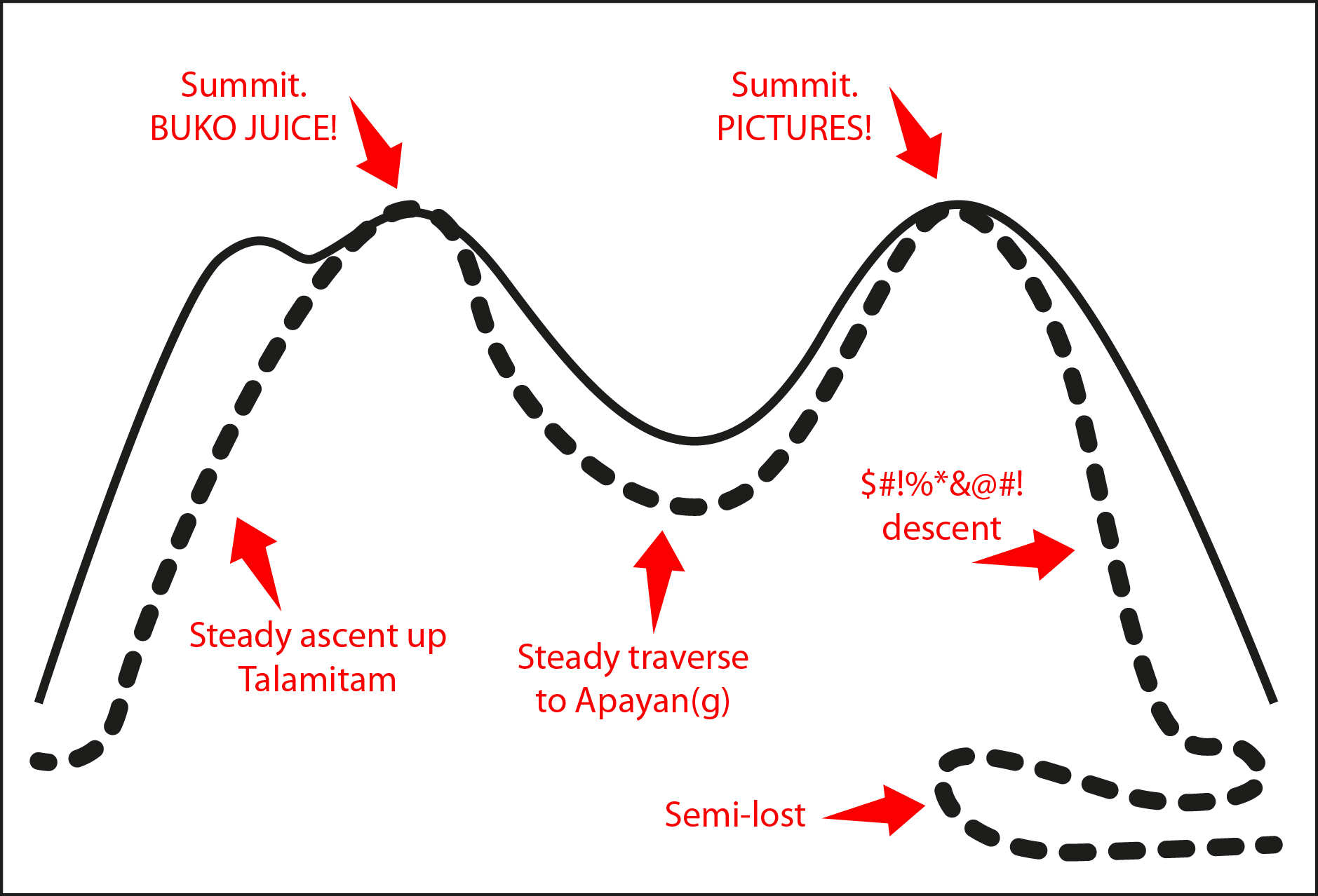
As you can see, the highlight of our climb was the expletive-inducing descent from Mt. Apayang which I will discuss later.
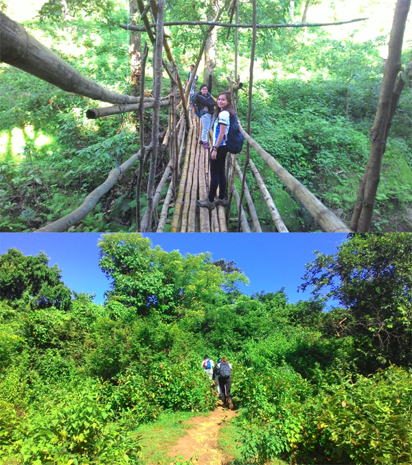
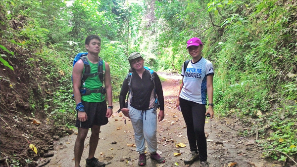
Traveling to the Talamitam jumpoff has already been discussed in my blog post for the said mountain. I won’t be commenting too much until the Talamitam summit because it’s pretty much the same experience. So I’ll let the pictures do the talking.
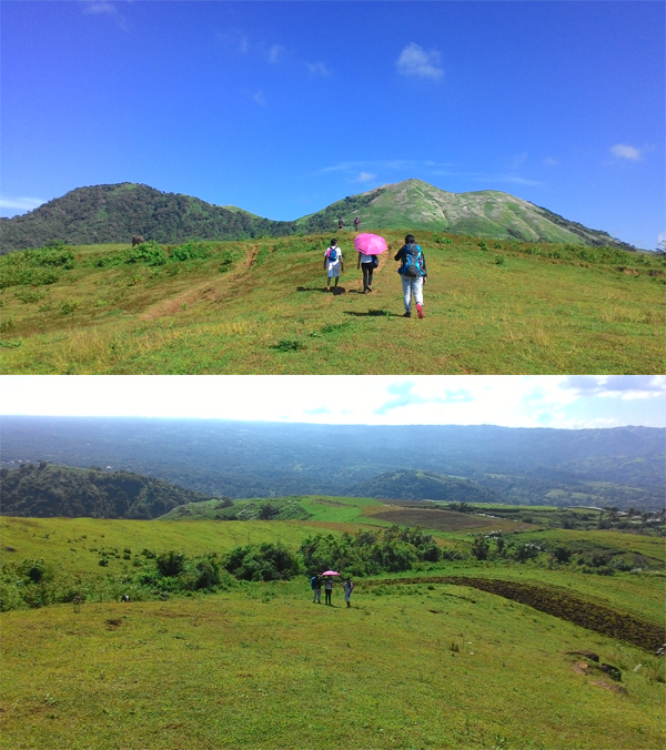
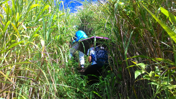
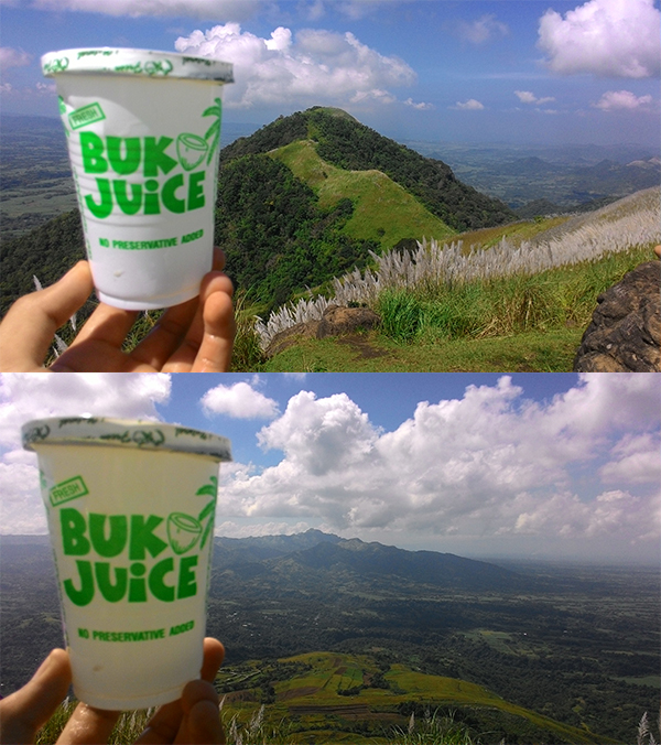
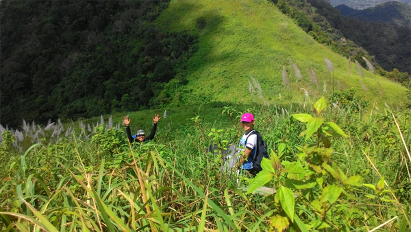
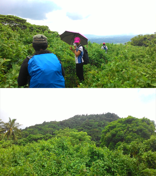
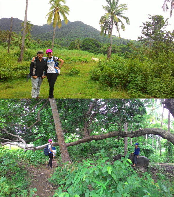
After enjoying some ice cold buko juice at the summit, we decided to start the traverse towards Mt. Apayang. The trail between the two mountains was a soft slope full of talahib aka overgrown grass with sharp leaves. The only challenge here was not being able to see the path because of the thick grass, and keeping the talahib out of your face. My friend who had an umbrella wisely used it as a shield against the foliage. I think that as the trail gets more developed and well-trodden that this won’t be a problem anymore.
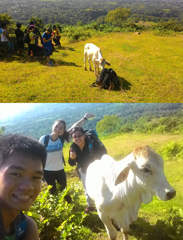
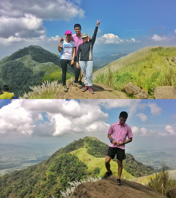
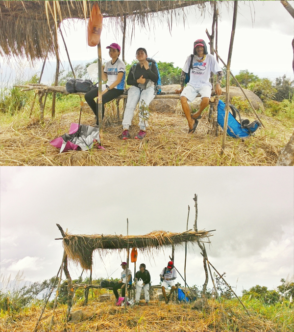
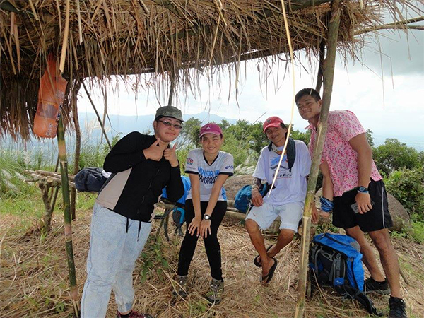
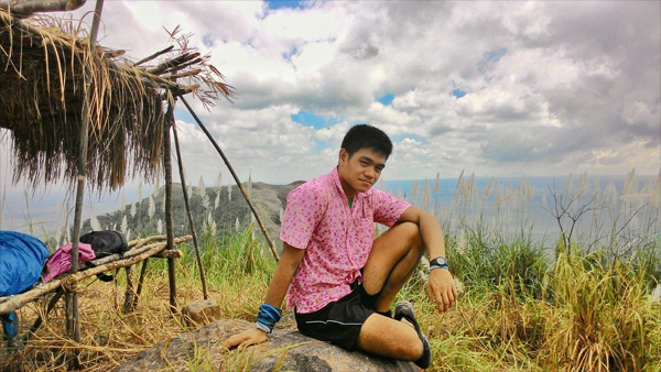
A few minutes after getting slapped in the face with talahib, tripping on rocks, and energy-sapping heat, we finally reached the summit of Mt. Apayang conveniently marked by a hut. We took the time to rest, rehydrate, and take some pictures.
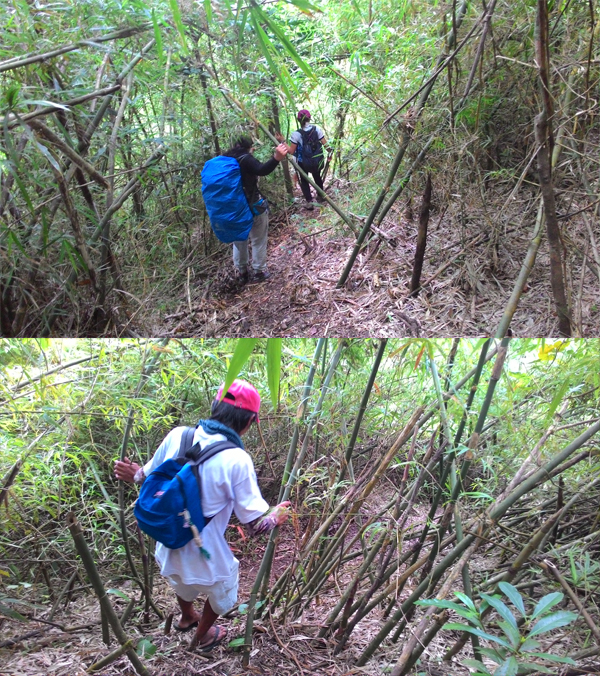
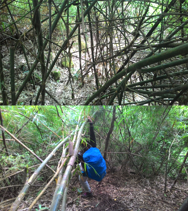
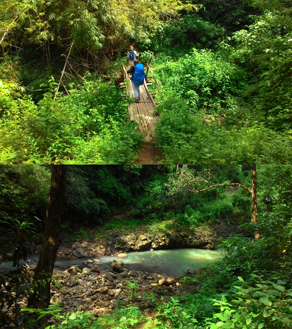
Finally, it was time to descend. Our guide told us that this was also his first time to use the trail, so we were all newbies embarking on this adventure. While the trail from summit to summit was under the heat of the sun, the descent was through a very thick forest.
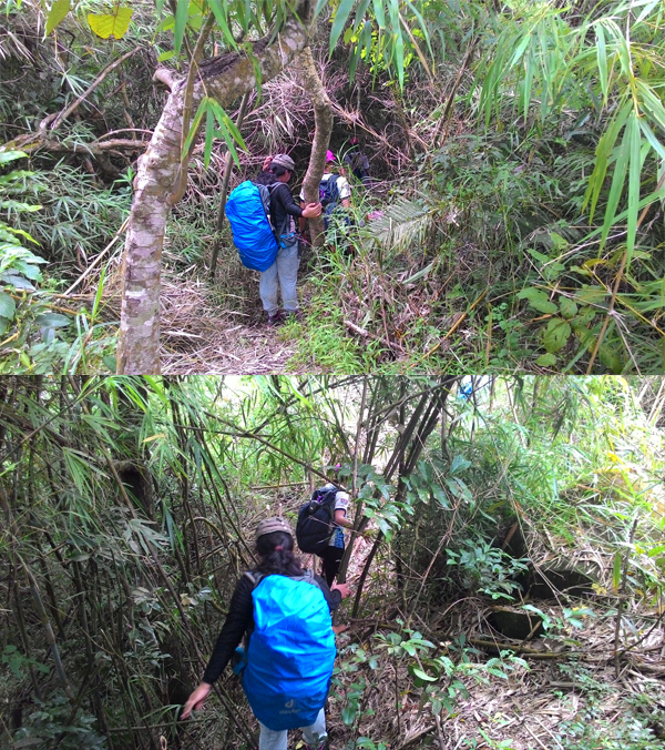
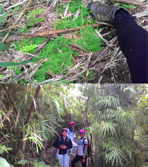
While it didn’t rain that day, the ground was still moist and we all had our share of slips and bumps. We fell a lot, slid a lot and cursed a lot. It was pretty funny and we were glad no one else was on the trail to hear us. Sometimes all you had to hold on to were thin bamboo and tree branches. Other times, you had to use vines to rappel down the inclines.
After a couple of hours in the forest, we emerged and passed through a river that signified we were going the right way. We were already very tired and we took some breaks to eat, get some shade and drink our steadily-depleting water supply. I was so glad when we saw a farmer riding a carabao who told us that we were going the right way, although he also told us that we were still far off from the brgy. hall.

More walking happened and there were even times where the trail disappeared or that there were multiple trails heading towards different directions. It’s a blessing that all of the trails we followed were the right ones. The local brgy. tanods were also texting our guide, giving directions and waiting for a signal from us to send their own guides to get us if ever we were lost.

Finally, we passed through some sugarcane plantations and saw some houses! We celebrated while walking towards the cemented road. At the junction, we were welcomed by a house with a sari-sari store. They gave us water and I bought a couple of softdrinks and chugged them down at once.

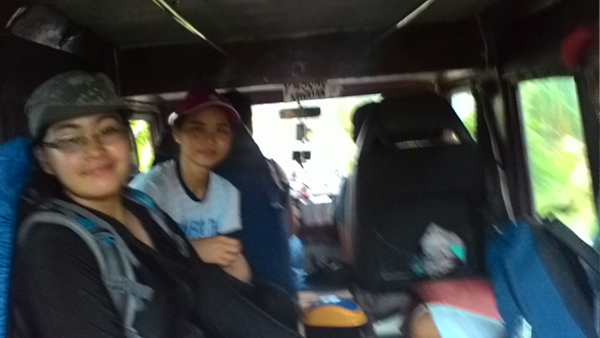
After a few minutes of waiting, the brgy. tanods arrived and helped us secure a jeep to the Brgy. Hall of Barangay Mataas Na Pulo. There, we registered our exit from the trail and took a trike to the highway. From the highway, we took a jeep back to the Talamitam jumpoff.
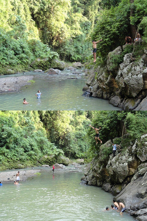
Back at the Talamitam jumpoff, we immediately had lunch and took a short rest. We were exhausted but we weren’t done yet. We descended back to Layong Bilog, the river-falls sidetrip!
Once again, we dived from the cliffs and swam in the river’s very cold water. We watched someone climb up a very high tree and jump off it. Maybe next time, I get enough courage to do the same.
After that, we went back to the jumpoff to fix ourselves and waited for the next bus back to Manila.
Itinerary and Cost Breakdown:
- 05:30 ETD Buendia, Nasugbu-bound bus
- P129 per head
- 07:40 ETA Sitio Bayabasab (Km83), Register and secure guide
- P40 registration fee per head
- P400 guide fee per day, for up to 5 people (We paid extra for the traverse)
- P3 Wiwi
- 07:49 Start Trek
- 09:29 ETA Talamitam Summit
- P40 Buko Juice
- 09:53 ETD Talamitam Summit
- 10:30 ETA Apayan Summit
- 10:45 ETD Apayan Summit
- 13:57 ETA Brgy. Mataas Na Pulo
- P20 registration fee per head
- 14:21 ETD Brgy. Mataas Na Pulo, trike to highway
- P60 per trike
- 14:38 ETA Highway, jeep to Sitio Bayabasan
- P10 per head
- 14:59 ETA Sitio Bayabasan, Lunch
- 15:30 Trek to Layong Bilog
- 15:50 ETA Layong Bilog, swim
- 16:35 ETD Layong Bilog
- 16:55 ETA Sitio Bayabasan, Fix Up
- P20 Ligo
- 17:46 ETD Sitio Bayabasan, Bus to Pasay
- P124 per head
- 21:21 ETA Pasay
Total Cost: P646
Safe Budget: P900
For those of you who want to start the traverse from Mt. Apayang, take the Nasugbu-bound bus straight to Kilometer 91 or Pasong Kawayan. From there, take a trike to the Brgy. Hall of Mataas Na Pulo where you will register and secure your guides. The people there are really friendly and welcoming so there are no worries.
This hike was very exhausting for me. In the words of Coldplay, “Nobody said it was easy, no one ever said it would be this hard.” Being beside Mt. Talamitam, I expected the trail to be more or less the same, but I was welcomed with the descent of a lifetime. I expected to get home around after lunch, but the day gave us lunch at 3 in the afternoon and I arrived home at around 10 at night.
But it’s not as if I regret anything about the climb. It was a blessing to be in good company to make the whole expedition worthwhile. I really feel like the whole climb gave us time to bond and made us closer than ever.
Thanks to Rosalie and Aiks for the amazing trip, as well as to kuya Randy, our guide. Thank you to my mama for not getting angry at me for arriving later than I thought, and to the big guy up there for not letting it rain until we were already on the bus

And that’s Mt. Apayang; conquered the summit, but the descent almost conquered us.
-jgzn
p.s.
It’s amazing how bad the traffic going home is. Almost 4 hours on the bus, slowly inching along the different parts of Cavite. On a Sunday. The worst part is, no matter how much sleep you get on the commute, you still end up tired and fatigued when you get off.

nice one brother!
LikeLike
Thank you, Sir!
LikeLiked by 1 person
Walang anuman sir. I enjoyed reading your posts.
LikeLike
I happen to stumble upon your page, which is very timely kase we’re planning na umakyat sa Mt. Talamitam next weekend. Pwede na pala twin hike! :-)
LikeLike
Hi! good luck on your climb next weekend! Yes it is doable, but expect to get really tired! Haha :)
LikeLiked by 1 person
Hiningi ko kay Aiko no. ni Kuya Randy. 800php singil nya pag traverse. :(
LikeLike
Talaga po, baka kasi nalaman niyo kung gaano ka hirap, haha! I suggest try niyo na lang mag Apayang-Talamitam traverse, baka mas mura if you start sa kabila. :)
LikeLiked by 1 person
we will do an apayang talamitam this weekend :) thanks for the informative graphics!
LikeLiked by 1 person
Thank you for reading! I hope your trip goes well! Be ready for an adventure! :D
LikeLiked by 1 person
Hello po. We are planning to climb Talamitam traverse Apayang. Can I have the no. Of your guide? Thanks :)
LikeLike
Hello! You can contact our guide, Kuya Randy, at 0929 182 6397 :)
LikeLike
ask lang po… pwede po bang umakyat sa dalawang bundok na ‘to na walang guide? as in self-guided solo pwede po? salamat :)
LikeLike
Yes you can if you are familiar with the trail. But it will pass through some farmlands and there are also other trails the locals use so may chance maligaw. :)
LikeLike
thanks!
LikeLike
Will plan to climb from Apayang to Talamitam Traverse and camp overnight.. thanks for this post!
LikeLike
Thanks for reading! Have a nice climb! :)
LikeLike