Sunday
April 23, 2017
Tarak ridge is one of my all time favorite mountains to hike because of its simplicity. It’s what others say is the gateway mountain to major climbs with its 4/9 difficulty; not too hard, but still has enough of a challenge. So when I got news of a new trail connecting Mt. Cuyapo to Tarak ridge, I looked for an available slot right away.
Our organizer was Deya, who is already a veteran in organizing hikes and you may find a lot of her hikes in the CLIMBER page. She was kind enough to let me hitch on her group and we assembled at the McDo in Kia Theater in Cubao. The time was 22:30 in the evening. After everyone was accounted for, we boarded our private transpo bound for Bataan. I didn’t know anyone in the group aside from idol Ben, a podium-placer and a big name in the trailrunning community. Oh, and sir Jherry Guiao, also a well-known organizer, was the driver since we were using his vehicle.
We woke up to have some coffee and some burgers at a McDo in Mariveles early in the morning. Here, I bought my packed lunch of two cheeseburgers. Then, we were on our way to the jumpoff in Limay. After some last-minute briefing and fixing up, we started our trek at 4 in the morning.
We hiked in the dark across some farmlands and into a rainforest. Along the trail, it was beautiful to look back and see the lights of the cities of Bataan. The ascent was gradual at first but once we entered the forest, it started to have more assaults. We took some breaks every 15-20 minutes until we reached the part near the ridge. Here, we waited for the sunrise because Deya told us that it would be dangerous to cross the ridge in the dark.
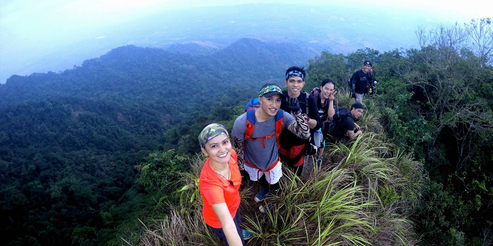
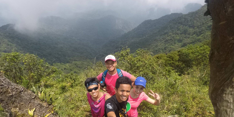
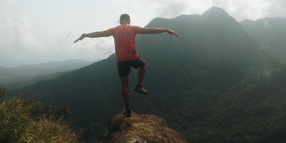
As the surroundings started to show themselves in the sun, we hiked up until we emerged into the ridge. It was breathtaking. The ridge and the surrounding views were very beautiful. And although the ridge wasn’t that long, it was certainly dangerous because of the loose soil and its very narrow width. If a hiker isn’t careful, they would definitely fall down and die.
After taking some pictures and videos, we walked along the ridge and into the forest again. The trail was very lose and clingy, with vines and thorns sticking out everywhere. One had to be very observant of the surroundings so that they won’t get injured or trip. Some parts of the trail also required us to pull ourselves up with the vines.
We reached a small clearing about 5 minutes away from the summit of Mt. Cuyapo. Our guide said that this was the turnaround point for most hikers before the traverse trail was made. We reached the summit and got a few pictures in. Unfortunately, it was a bit foggy so most of the view can’t be seen very well with our cameras. But we saw with our own eyes the wonderful ridges and bumps in the surrounding landscape.
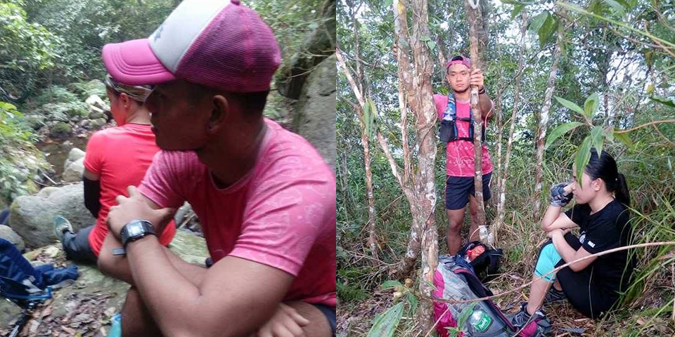
After the summit it was a steep descent where we had to hold on to the nearby trees so that we won’t slip and roll down the mountain’s face. The trail was around 95% rainforest with some interludes by open trails covered in talahib. After reaching flat ground, we hiked some more until we reached Oliver’s River, the one and only water source before we reached Tarak ridge. Here, we had some lunch, refilled our bottles and even had a quick nap. After an hour of resting, we started the next part of the hike and the one Deya said was the most difficult part.
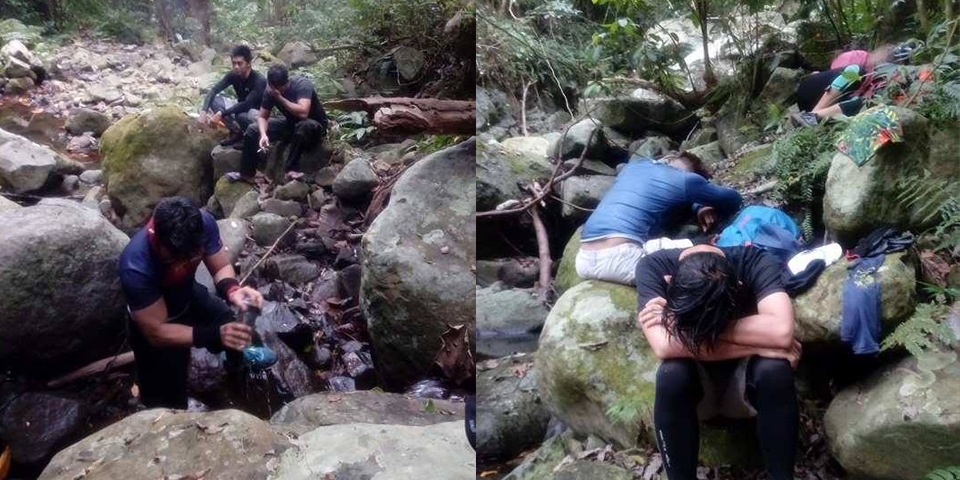
After, the river, it was mostly all assault until we reached the Oragon peak, one of the highest parts of the trail. I believe this was much higher than the summit of Mt. Cuyapo, though I’m not sure but the assault made it feel like it was. There was even a part of the trail where we had to use a rope brought by the guide in order to advance. The trail was very young and un-established, there were sharp plants and vines everywhere and I had to stop a few times because they kept grabbing my hat.
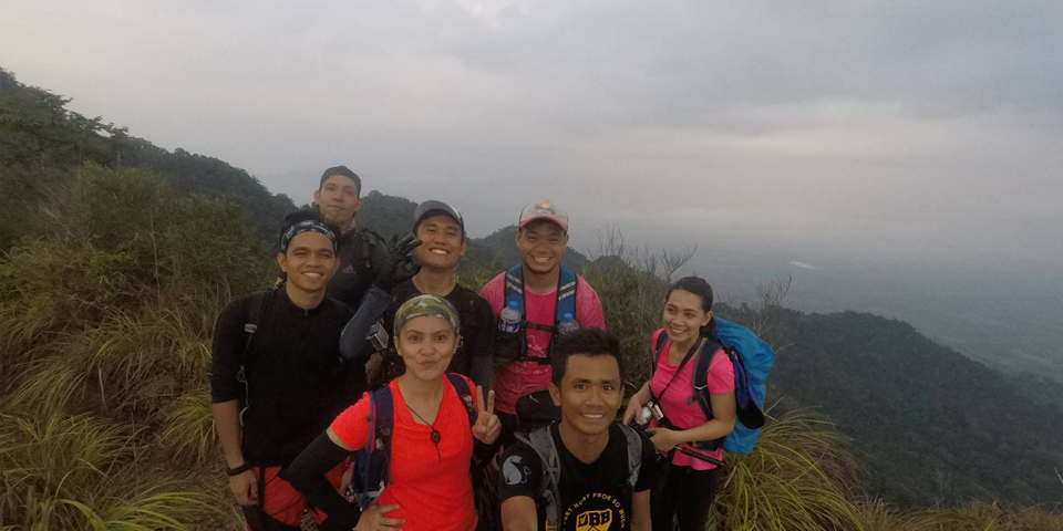
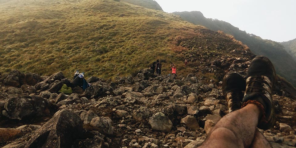
Fortunately, the hike was made bearable as Ben and I and also some others along the trail were just making chismis to pass the time. Every time we had to rest, we were talking about different things from other hikers to hugot lines. Finally, we reached Oragon peak and after a short time of taking pictures, we advanced on, knowing that Tarak ridge was getting nearer and nearer. We passed by Bintana peak, El Saco peak, and finally up to Tarak peak where the world tree once stood. Then we went down to the ridge and took some pictures.
Unfortunately, there was no wind at the ridge when we arrived. It was just the heat of the sun bearing down on us so we quickly went down. To make matters worse, it had just freshly rained on the Mariveles side of Bataan, so the trail was very slippery. This was a bummer to me because I was looking forward to the downhill bomb of Tarak ridge. So, we had to maneuver down the slippery rocks and mud all the way down the familiar trail to Nanay Cording’s place and finally to the jumpoff in Grafane farm, where sir Jherry was waiting for us.
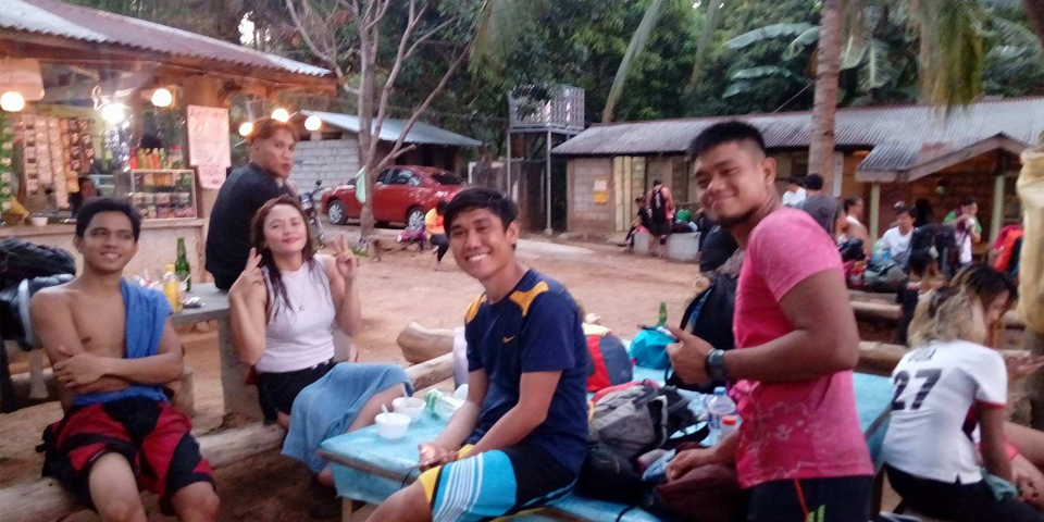
I immediately fixed up and washed my muddy shoes and got some sleep in the van as the others were eating and waiting for the rest of the group. When everyone was accounted for, we were on our way back to Manila. We again had a stopover in Mariveles for dinner where I stuffed myself with Jollibee. Then, I was asleep until we reached Cubao at around 00:30 of the next day.
Itinerary:
- 23:00 Day 0 ETD Cubao
- 04:00 Day 1 Start Trek
- 06:00 Knife Edge
- 06:50 Mt. Cuyapo summit
- 10:00 ETA Oliver’s River, Water Source, Lunch
- 11:00 ETD Oliver’s River
- 14:00 Oragon Peak
- 15:30 El Saco Peak
- 15:45 Tarak Peak
- 16:30 Tarak Rige
- 17:45 Tarak Ridge Jumpoff (Grafane Farm)
- 00:30 Day 2 ETA Cubao
Budget: I paid P1,300 for this organized hike, but for DIY trips, the budget might be around P1,000-1,200 depending on the number of hikers.
Tips:
- Wear protective clothing. The trail is wild so if you are fussy with your skin, wear appropriate protection.
- Conserve water. The only the water source is in Oliver’s river about 6 hours into the trek. This is before the hardest climb up to Tarak. The next water source is the Papaya river in Tarak. I brought 2 liters of water with me plus a bottle of Gatorade.
- Proper footing. Be careful where you step because there are vines and thorns and loose soil everywhere. You might fall and die if you don’t focus. This goes for the places you put your hands as well.
- The ridge going to Cuyapo is beautiful. Enjoy it.
It felt good to be back in the trails just getting down and dirty. The trail felt like a lovechild of Mt. Apayang and Mt. Arayat, with some Toong trail thrown in the mix. I don’t really like newly opened trails because they’re mostly biased for short people, but it was good to once again be torn apart by nature. I’ve got lots of holes in my shirt and mud in my hat to show for it.
Thank you Deya, for the good organization and the success of the climb. As well as to Sir Jherry for patiently waiting for us, I give my thanks. Hoping to get another chance to hike with you both in the future.
Also to idol Ben, sorry I didn’t get the chance to take a picture with you. Thank you for the chismis and the push to finish this trail. Goodluck on your Hardcore Hundred. Thank you also to Mitchie and Joni for the pictures and the conversation. I hope to someday climb G2 so I can be as harkor as you guys.
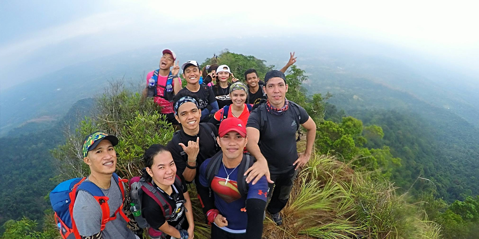
Also to the others I met along the trails, superman and his group, Ella, Mae, and the rest. Congratulations to us for finishing this mountain.
And lastly, to the Big Guy for giving us good weather on the side of Limay and for keeping everyone safe. AMDG.
I really enjoyed this trail and though I’m not looking forward to doing this again ASAP, I’ll surely return here after maybe a decade or so. Hopefully, there’ll be less fog on top and more wind on the ridge. Thank you for reading.
Hike safe and enjoy,
-jgzn
