Saturday
September 2, 2017
Finally! I have reached the crater lake in the famous Taal volcano. I’ve always passed by the volcano when going through Tagaytay, but I’ve never really put effort into going to it. Then on a free weekend, I saw my friend Enciong post about a hike to Taal, via a different route than the traditional “tourist trail.” I messaged him immediately to secure a spot. At first we were waitlisted, but then more slots opened up for Khat and me. Yay!
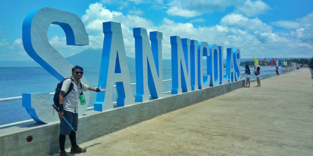
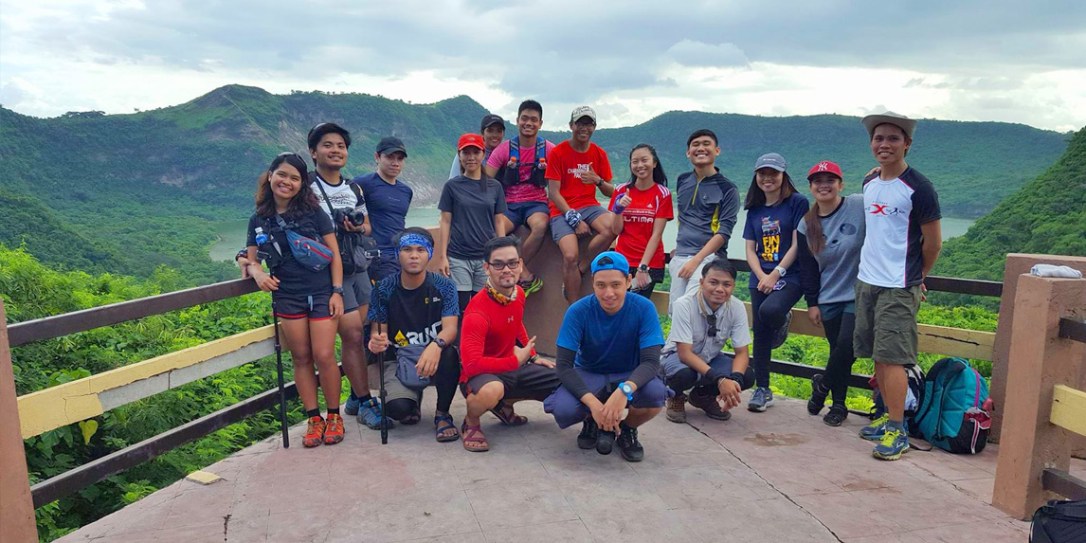
The group assembled at Cubao early Friday night. We were exactly one van and once everyone was accounted for, we rode all the way to the jumpoff in San Nicolas. This was near Lemery in Batangas and was one of the cities sitting on the outer bank of Taal lake.
From afar, we could see Tagaytay. In fact, we were on the other side of the lake nearly opposite it. Enciong told us that the trail has long been unused, and we were the first group to hike it again. I prepared myself for some bushwacking and going through narrow and steep trails. To make us more excited (or scared), Enciong showed us a graphic that says that this trail is the most difficult of the three known trails to the Crater lake.
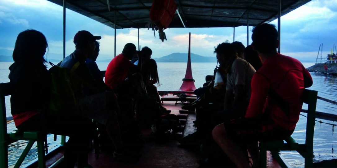
Anyway, once we reached San Nicolas, we bought some food and waited for the drizzle to pass as Enciong coordinated with his contact. Then finally, we boarded a cute little boat as we crossed the lake into the Volcano itself. The lake was full of tilapia farms and I was surprised to see lots of settlements on the inner bank. These people were going on with their everyday lives, literally living on a volcano! Once we reached the inner bank, the boat dropped us off and told us he will meet us on the pickup point some distance away. This is because the trail is actually a traverse.
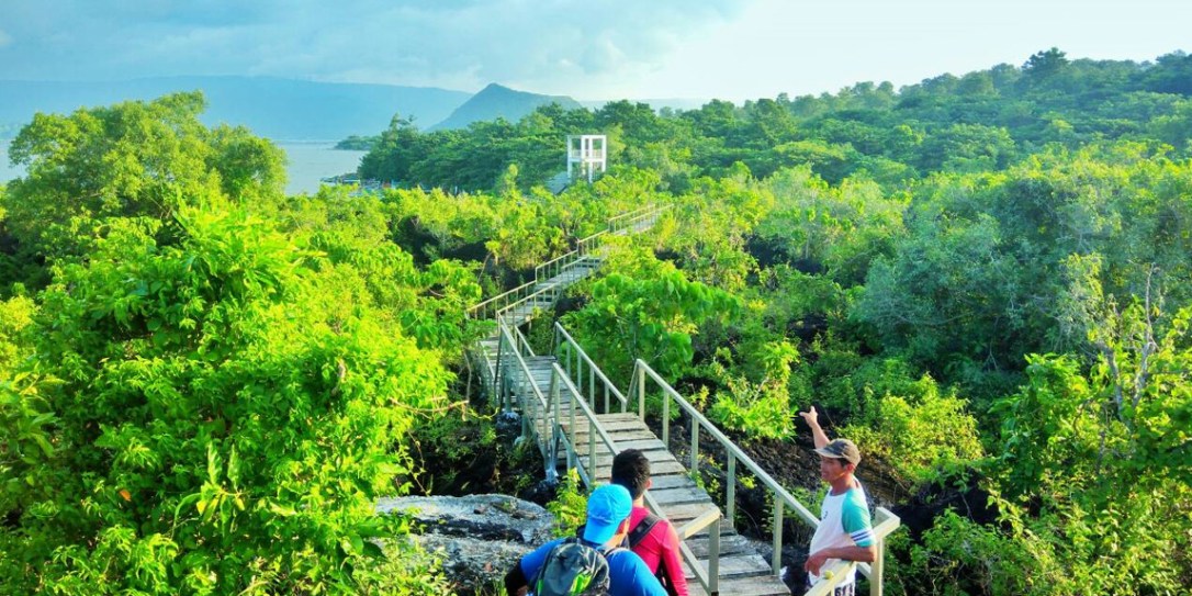
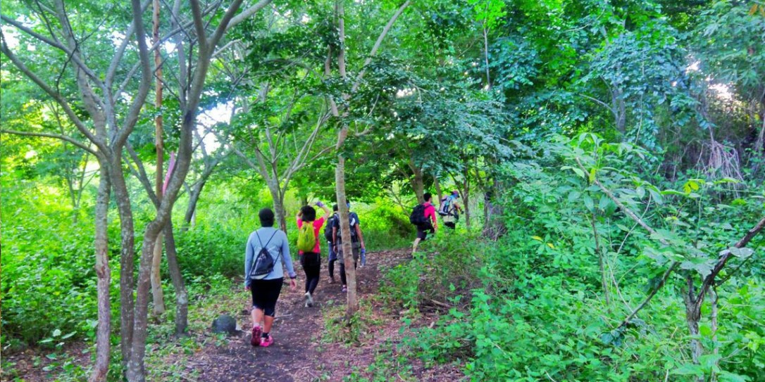
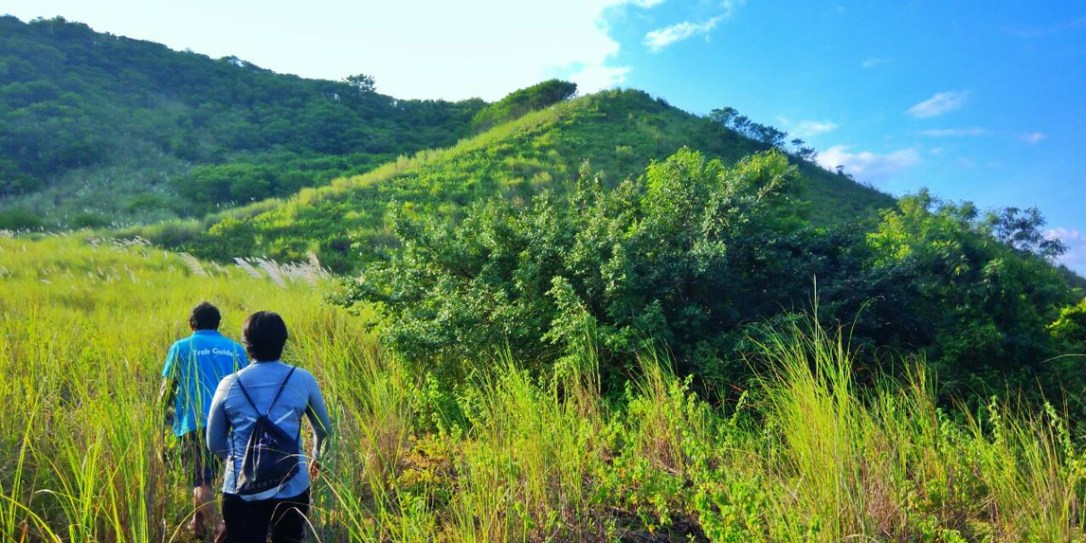
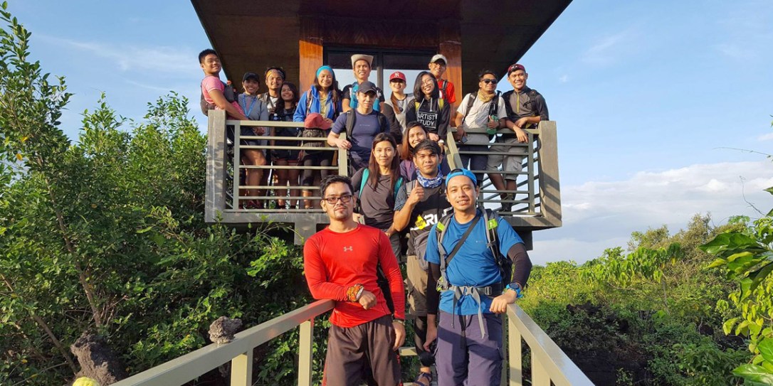
We met with the kind tourist coordinator who gave us our guides for the day. After some few reminders and trivia, we started off. Our first destination was Mt. Tabaro and it’s crater, formed in a second eruption in 1965. This was the latest eruption of Taal. So we hiked on the trail that was freshly opened for us. I was surprised to see that the trail was quite established. It was mostly flats up until we started to climb up to a viewdeck. Here we can see Mt. Tabaro and also the hill that hid the crater lake inside it. We went down from the viewdeck and waded through thick talahib until it was time to climb Mt. Tabaro itself.
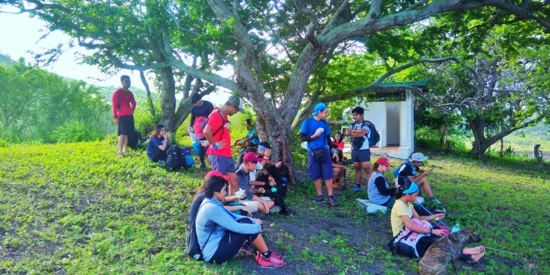
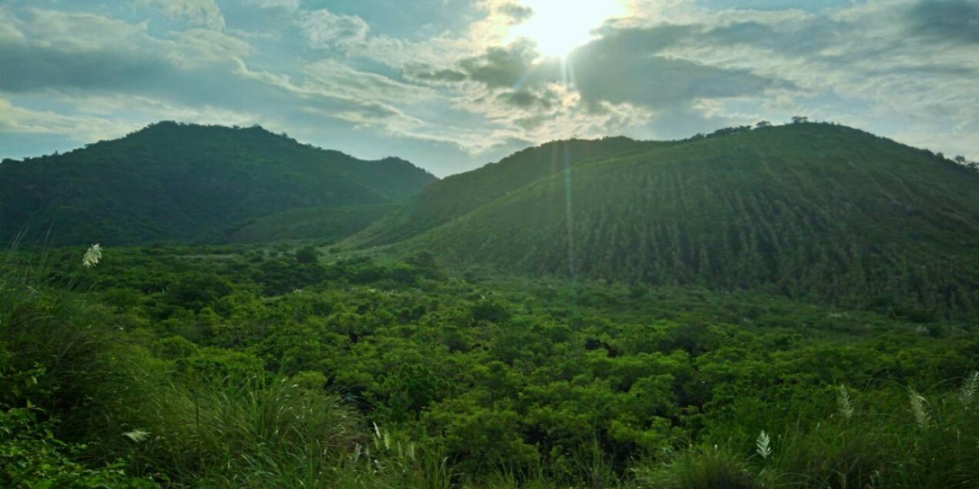
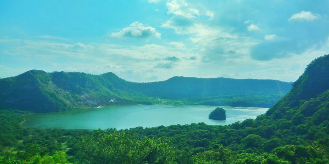
The climb was short and sweet, not too steep but just enough for a warm up. Our guide let us go ahead, and told us to keep climbing until we reached a big cliff. And so we did, with me asking myself ‘where’s the cliff?’ until the foliage cleared and I saw it right in front of me. Woah. The crater was massive. Imagine an enormous natural bowl. And we were standing right on the edge. It was breathtakingly beautiful. It was my first time seeing a crater up close, like a huge bite was taken from the earth.
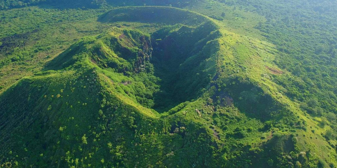
When our guide reached us, he told us that all the mass that is missing from the crater was transferred to part of the lake, reclaiming it and turning it into the exact place where the boat dropped us off earlier. Coooool. He also told us that the dirt spewed by the eruption was rich with metals and minerals and were actually harvested before by the government. It’s the reason why the rocks there looked like dirt but were as rigid as metal when touched.
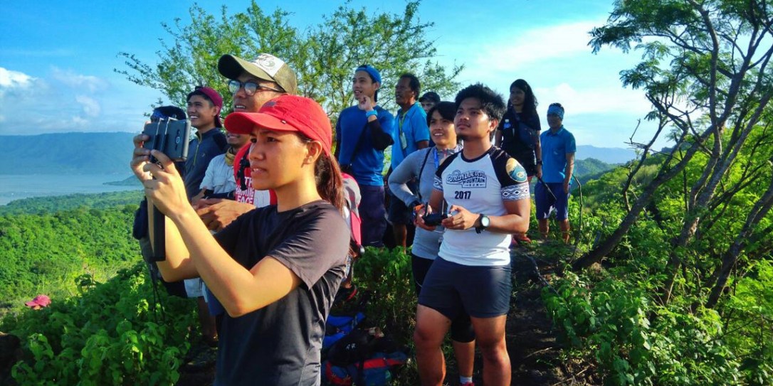
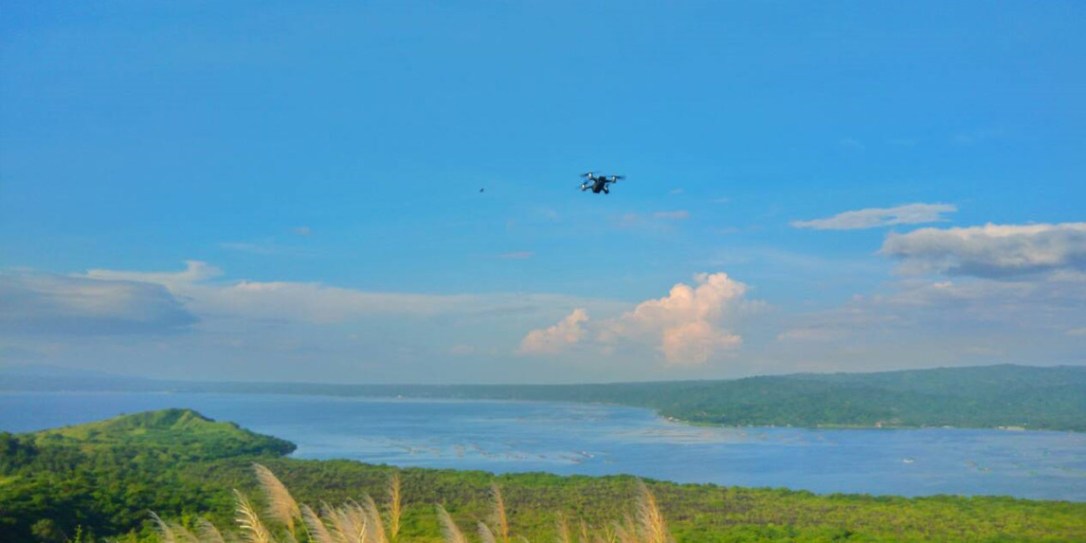
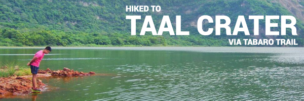
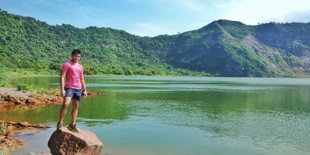
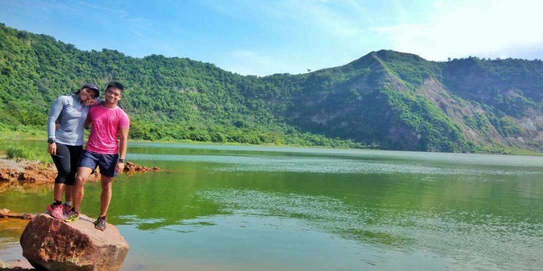
After some pictures and drone shots, we continued our way to the actual crater lake formed in the 1911 eruption. This was actually the longest part of the hike. With lots of rolling downhills and uphills. There were also some uphill steps but Khat and I enjoyed the runs down more. We eventually reached a viewdeck built by the locals and it overlooks the crater lake. Once I got on top and looked at the view, I was mesmerized. It looked so serene and some parts of the bank were smoking out gas. From afar we could see the viewdeck of the traditional trail up high. But our trail enabled us to go to the actual lake itself and take a dip in its waters. So after some more pictures, we descended further until we emerged right beside the lake.
There, we took our time with pictures and getting a breather. Some of the group took lots of artistic pictures and dipped their feet in the healing waters.
After quite some time, we started our ascent back to the viewdeck and took the traverse trail. It was mostly rolling downhills until we reached the village where our boat would pick us up. When we were complete, our boat appeared and took us back to San Nicholas. Back at the jumpoff, we fixed ourselves up and then took the van to the municipality of Taal for the heritage tour.
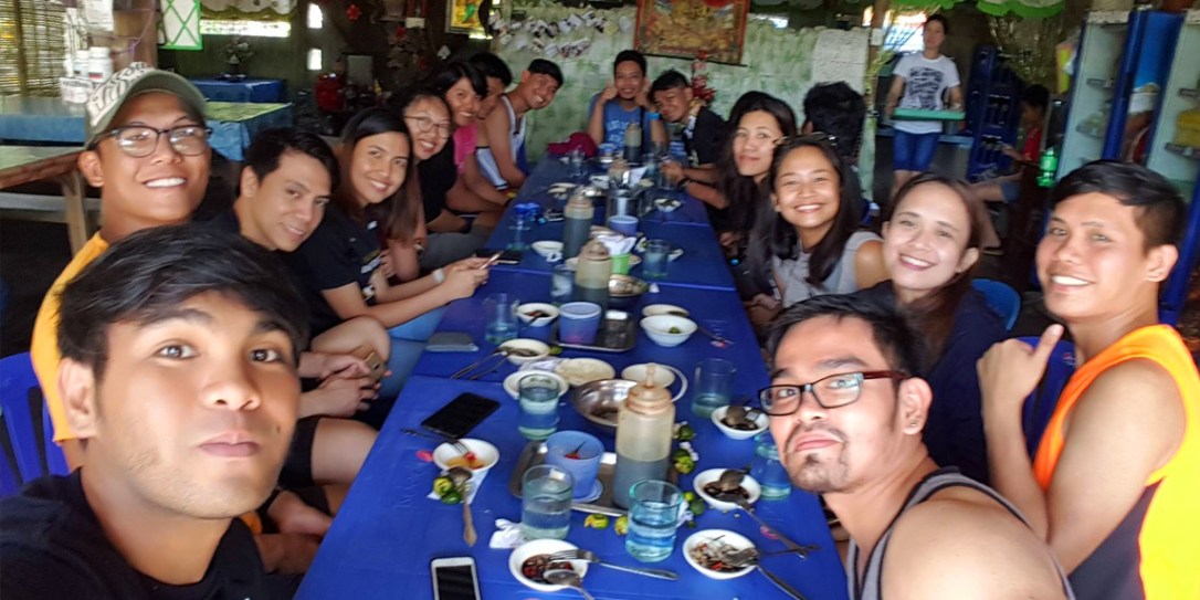
BUT FIRST! We took our post-hike meal at a local Lomihan. Nothing tastes like authentic Batangas lomi. Yum yum. Khat and I shared three bowls of the stuff before we were full.
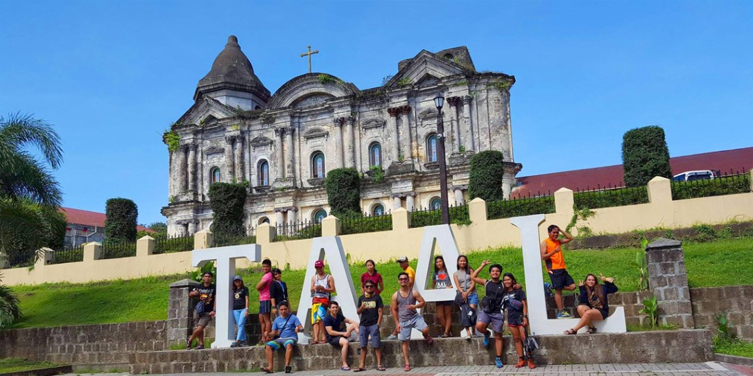
On the way to Taal, we passed through Brgy. Balisong and I saw lots of stores selling those authentic folding knives. At Taal, we alighted at the gigantic 600 year old church and explored it. Then we went through some old roads and looked at the ancestral houses there.
Finally, we capped off the visit with a cold and refreshing halo-halo. The vendor was kind enough to give us unlimited ice and milk. Thank you, kind kuya, God bless you! With our stomachs full, we boarded our van and slept all the way back to Manila.
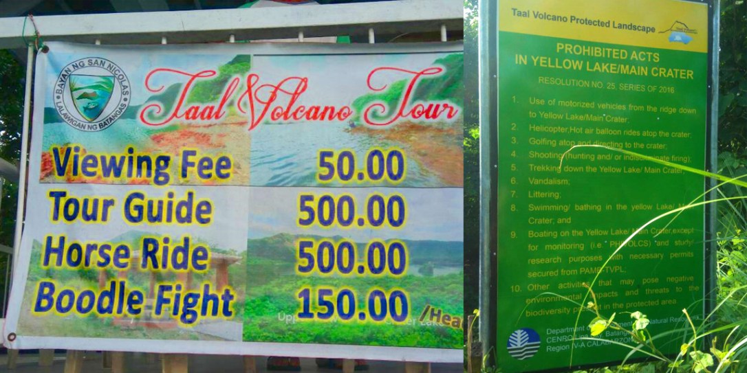
Itinerary and Cost breakdown:
- 05:55 ETD San Nicolas, Boat to Taal
- P3,500 Boat Fee for 10pax, P100 per pax in excess
- 06:25 ETA Taal, Orientation
- P500 Guide fee 1:5
- 06:45 Start Trek
- 07:20 Mt. Tabaro Crater
- 08:45 1911 Crater Viewdeck
- 09:05 ETA 1911 Crater, Photo-ops
- 10:10 ETD 1911 Crater
- 11:05 ETA Sitio Siksikan, Boat to San Nicolas
- 11:50 ETA San Nicolas
- 12:00 Lomi Time and Taal Heritage tour
Safe budget: P800
Thank you to Enciong and Noah for organizing this hike. To Mang Ruben for touring us around Taal and for the entertainment. To Abby and Jervis for the drone shots. To all the other joiners for the companionship. It was nice hiking and eating with you guys. Shempre, to my bebelabs for being there with me. And most of all, thanks to the Big Guy for the wonderful weather and for a safe hike.
I would recommend this hike for beginners. It’s a nice halfday hike and can be complemented with other sidetrips near the area. I can also recommend this one to those who have already climbed Taal via the tourist trail and want more of a challenge. It’s also the trail straight to the crater lake, whose waters are believed to have special healing powers for those who bathe in it. It’s also a wonderful place to run, the soil is soft and cushiony and the trail is quite runnable. On a good day, one can probably run out and back a few times.
Taal, done! I might try the tourist trail some day just to see the other side of the crater, but I’m already claiming this to be my favorite Taal trail.
-jgzn
P.S.
Here are some more pictures from the hike!