Sunday
June 23, 2019
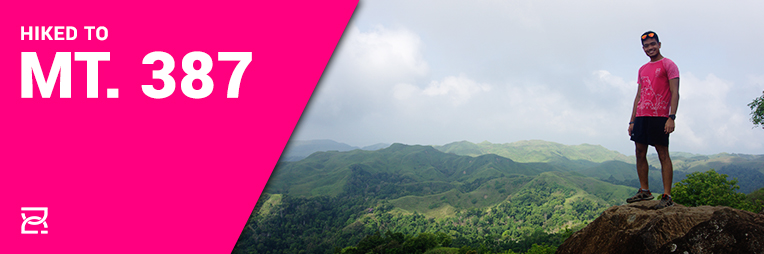
Because bebelabs is finishing her Asia Trail Master Grandmaster quest in Malaysia with the Penang Eco 100, I had a free weekend where I didn’t have anything planned. So I used it to finally hike a mountain I haven’t been to before, Mt. 387. This is my hike account.
Mt. 387 is a mountain in Nueca Vizcaya that is part of the Caraballo mountain range. It got it’s name because of its 387-hectare land area. It is considered a minor cimb but it can exponentially increase in difficulty depending on the weather. It is a relatively new hiking destination, having opened last 2018. Because of its ease of access , it has become a good hiking spot for beginners, drawing in lots of crowds especially during the weekend.
It’s also a mountain I’ve planned to climb for a while now. But with all the races and other activities this 2019, I only got around to it now after finishing the Echigo Country Trail.
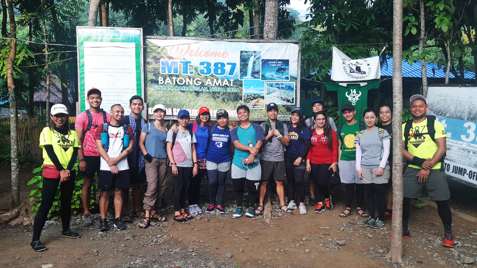
I looked for an event in CLIMBER and found one that fit my preference. We met up at the usual place in Greenfields district and at around 1 in the morning, we were off to the north. Joining me was my trail running idol and friend, Jepjep.
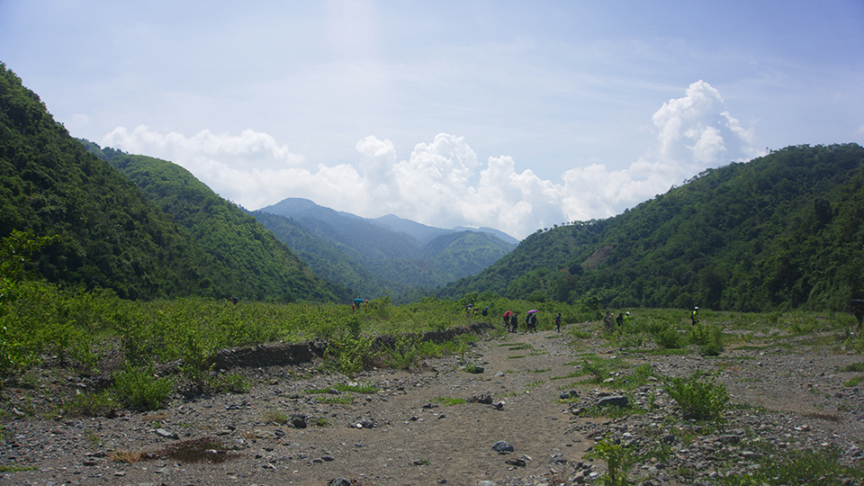
As dawn broke, I woke up and we were already in the jump off at Puncan. There, we registered and waited for our guides. Sir Roy of the Nueva Ecija DENR gave us a short briefing about the mountain. When our local guides arrived, they prepared our mandatory tree sprouts and we started the hike.
The first part of the hike was through a dense forest that was shockingly beautiful. Shocking because I didn’t expect it to be that thick and verdant. It was like the forests in Jurassic Park. It felt like we were hiking through a carefully curated wildlife park. There’s just something about the trail that I enjoyed immensely. Exotic trees and ferns lunged at us from all directions. I could hardly complain about the uphills because I was too busy admiring the vibrant green forest.
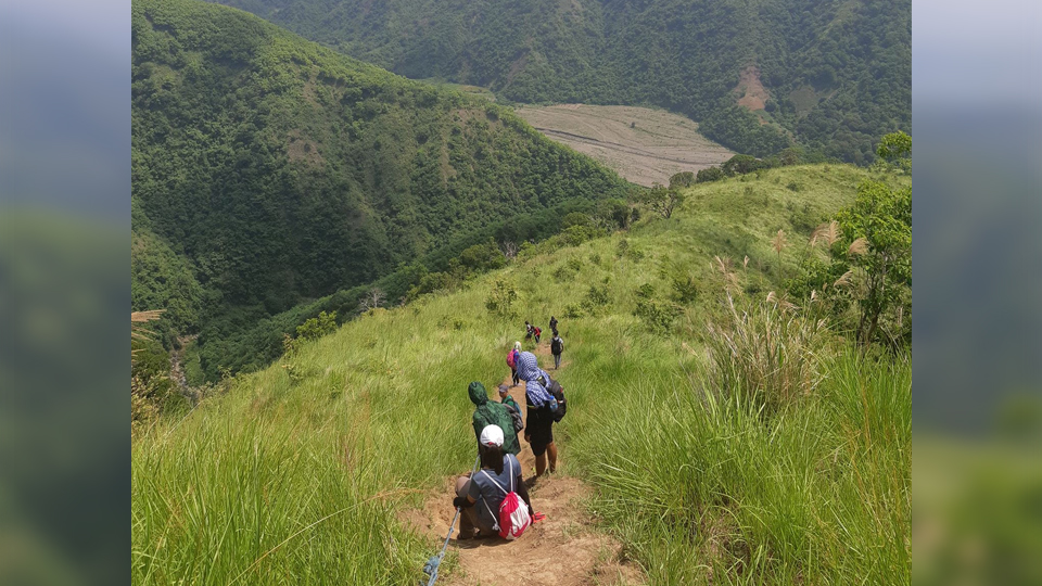
It was a gradual uphill until the scenery changed to a more open grassland. Part of the trail here were some huge pine trees. Our guide told us how wild pigs used to inhabit the place and that this was once a lush forest until the people cut it down for lumber and charcoal.
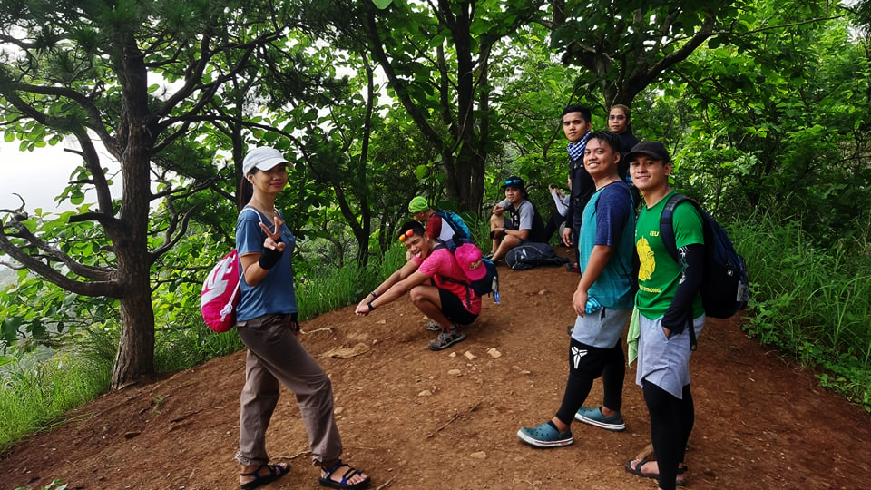
It was more gradual uphills until we reached a ridge where the soft morning air blew towards us. Our guide told us that windmills were supposed to be placed here because of the wind’s strength and consistency in this area. At this point, it was still overcast and foggy, so we couldn’t really see the entire view around us. After a breather, we continued with some more gradual uphills.
Eventually, we reached an open expanse of trail with the occasional tree here and there. From this point we can see the summit, which was marked by a Philippine flag. Our guide jokingly told us that the flag was a recent addition just in case the Chinese plan to occupy the area. We could also see a huge amount of people lining up for a picture in the massive rocks right before the summit. This was the popular “Batong Amat.”
It was named after the local word for ghosts. Apparently, during the war, Japanese soldiers clashed with the local and American troops in this area. Many Japanese were in the territory that they even dug war tunnels all around the place. There was even one near the rock formation! It was called such because local beliefs say that every now and then, ghosts of Japanese soldiers would come back to the area and can be seen at night. Creepy.
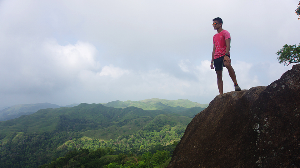
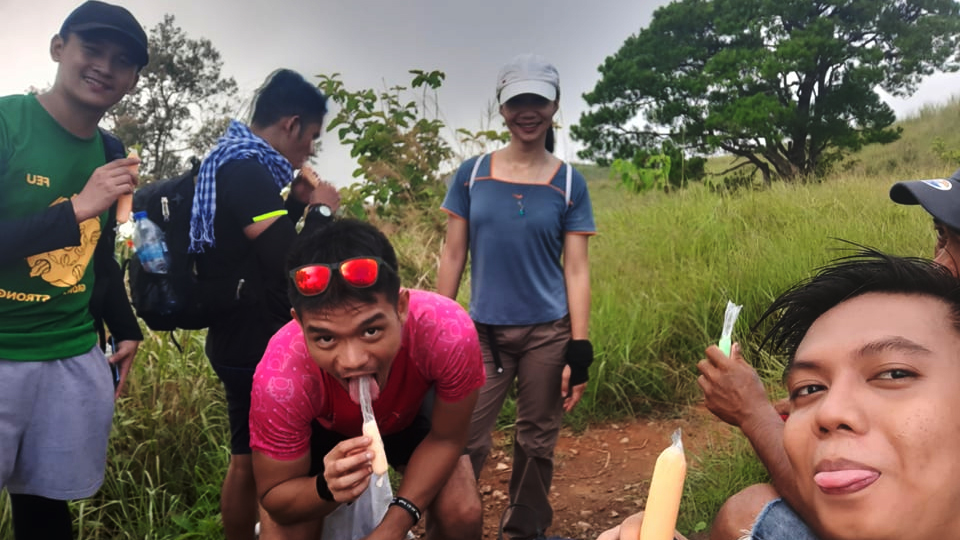
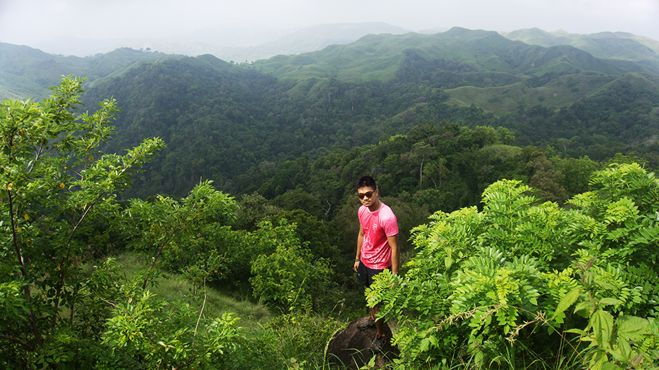
We waited for our turn at the picture taking spot and ate some ice candy being peddled by the local kids. We also waited for the clearing of the fog and eventually it revealed the reason why people liken this place to the chocolate hills of Bohol. Beyond us were lots of tiny little hills and bumps that looked oddly adorable. The surrounding hills did look reminiscent of the chocolate hills, but they had their own beauty. It was a sight that was well worth the hike.
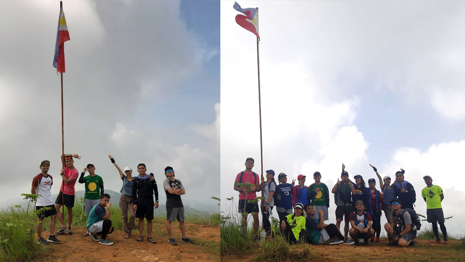
Finally, it was our turn to take pictures and we had a group picture at the Philippine flag as well. After a short descent from the summit, we reached the campsite where the lover’s tree stood. I don’t know why they called it that, but it was a lone tree which can be climbed on. We had another group picture here before we started the descent to Aloha Falls.
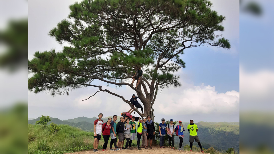
Are you keeping track? This mountain has a lot of landmark features. Batong Amat, Lover’s Tree, Aloha Falls.
The climb up to the summit was quick and easy, but the descent to Aloha Falls was quite a task. It was steep and dusty, with rope for assistance. It is even advised to bring gloves just for this portion of the hike. I had no problem with going down because thankfully it wasn’t raining, but I imagine it would be wet, wild, and dangerous if it was.
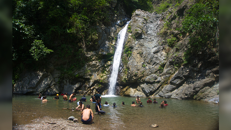
Once we finished rope section, we followed the river straight to the Aloha falls. It was…cute. There were already a lot of hikers swimming in the basin. I ate my packed lunch and took a quick nap before dipping myself in the cold water. It was very refreshing! The water was bearable and the basin deep enough for a swim.
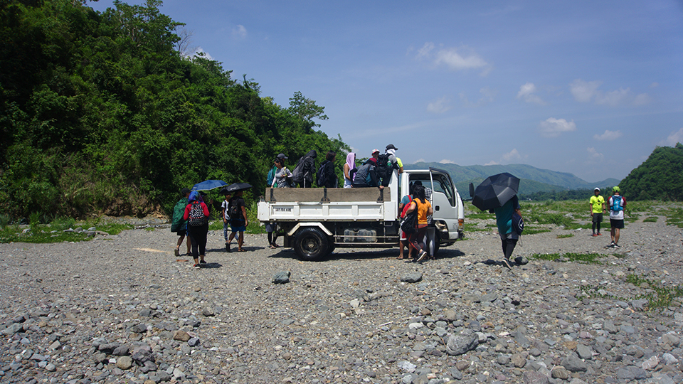
Finally, it was time to finish the adventure… We hiked back to a junction and took the way going to the open plains where the ELF truck can pick the others up. From the extraction point, one has a choice to pay P20 for the elf truck to bring them to the jumpoff or they can hike it back for around 15 minutes. We did the latter to get a bit more mileage.
After some brisk power-walking, we arrived back at the jumpoff and waited for our paluto. This officially ended the hike. After eating, we fixed ourselves up and we were soon back on the road to the metro.
Itinerary:
- 06:30 Start trek
- 08:20 ETA Summit, Photo ops
- 09:15 ETD Summit
- 11:00 ETA Aloha falls, lunch and swim
- 13:15 ETD Aloha falls
- 14:00 End of trek
Cost breakdown:
- P50/head registration and tree planting fee
- P350 guide fee, 1 guide per 7 hikers
Thank you to Team Rexxa and Garlin for accommodating us on such short notice. It was well handled and despite the eventful things that happened on the way back to Manila, we were well taken care of. Thank you also to the kind hiking buddies that we met for the conversations and photos. See you on the trails! And of course, thanks to Jeff for accompanying me in this hike. I hope this short but sweet adventure kept your mind off the cookset that’s been missing in your life for 2 years. 😘
It was fun to take a relaxing hike after all the race-filled months that have passed. Taking the time to stroll through nature at a leisurely pace can be quite de-stressing. I’m happy to have added another mountain to my climb list. After a lot of mountains I’ve been to, even the minor ones contain a special beauty in them and they should not be overlooked.
Happy trails, happy snails!
-jgzn
