Sunday
February 26, 2017
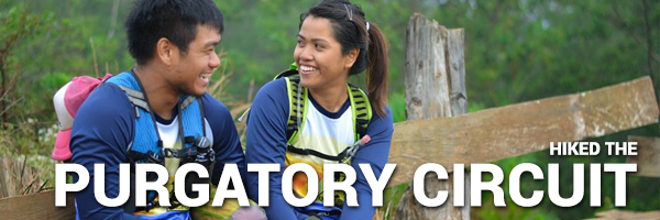
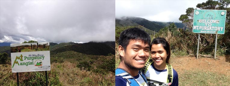
On a streak of spending time in the mountains of the north, Khat and I signed up for a Mt. Purgatory dayhike as recovery for the recently concluded Mt. Ugo Marathon. The original plan was to hike Mt. Pulag but since the event was postponed, we were free to participate in this quick climb.
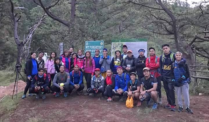
The organizer was once again ate Hannah of Adventure Passport. This is leg 2 of her Benguet dayhike series, the first was the Mt. Ugo one I also attended. Thankfully she still had a couple of slots left in her 2 vans. We assembled at Cubao and after a brief meet and greet, we boarded our van and got some sleep all the way to the jumpoff. The cold morning air slapped our faces as we got off the van and I tried to shake it off by walking around.
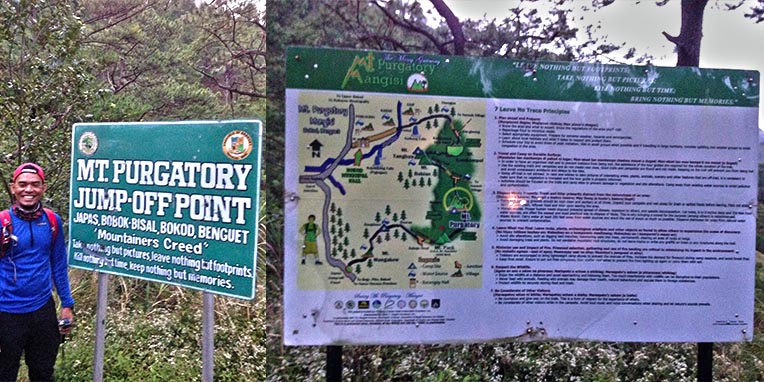
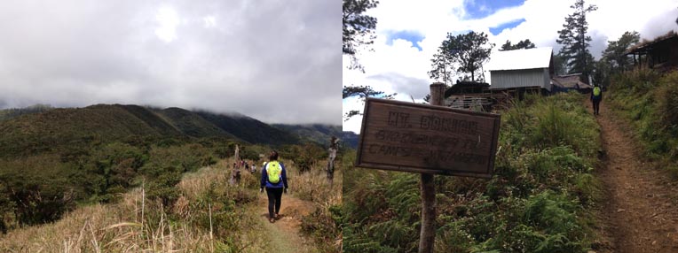
After securing our guides, we had a short briefing before starting the hike. The initial part of the trail were concrete uphills and established trails very reminiscent of Ugo. Indeed it was once again surreal to be surrounded by the tall and ancient pine trees. Eventually, the morning fog gave way to show the view of the surrounding peaks and valleys.
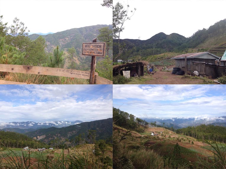
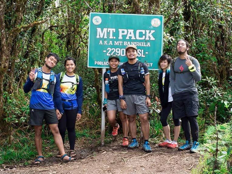
It was a steady ascent until we reached Mt. Mangagew and its community. Here was the last part of the trail with a store so hikers can have their last cup of coffee and stock up on their supplies. After this part, the local paths gave way to rolling trails and a steady, mossy ascent to the prominent Mt. Pack. This mountain was supposedly the highest peak in the circuit so we were glad to finally finish the highest ascent. We had our pictures taken and had a quick rest while waiting for the others.
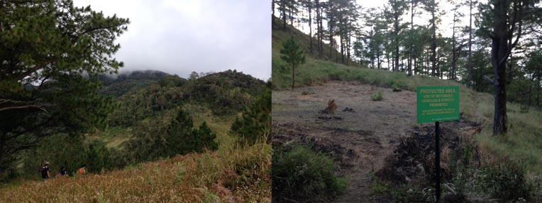
Moving on, the next part of the trail was a difficult one. It was into the mossy forest once again only this time, the trail was wet and muddy. Wearing only sandals for the hike, Khat and I slipped and slid our way to the next peak, Mt. Purgatory, which the circuit was named after. To be honest there wasn’t much ascent as Purgatory is lower than Pack.
I was actually surprised that the summit marker was already there. We had a quick rest for pictures before heading to the next stop, Mt. Bakian where we will be having lunch, my favorite part of the hike. It was more mud again going down the mossy but beautiful trail of Purgatory. I forgot how many times my foot got swallowed by the mud.
We reached Mt. Bakian where there was another local community. Here, they had cooked our lunch for us. We waited for the group to be complete and in the meantime, we relaxed in our hammock. When the group was complete, we had our lunch of adobo and tinola and it was so satisfying. Food really is better in the mountains. After lunch, I had a quick poop before we headed to Mt. Tangbaw, a nearby peak and the assembly point before hiking the last major mountain which was Mt. Komkompol.
After playing with the local kids for a bit, we resumed our assault of Komkompol. The trail was beautiful and changed from pine forests to mossy forests. It was almost all uphills although thankfully not that muddy anymore. After more than an hour or so, we finally got to an opening and there, the summit marker of Mt. Kokompol stood.
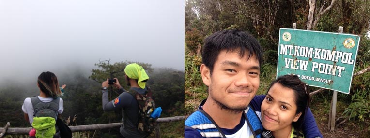
Of course, we took lots of pictures and waited for the group to be complete. Sadly, the late afternoon fog was fast approaching and there wasn’t much to see. As the cold started to reach my bones, we started our descent. Going down was way easier and faster, there were some points where we even ran down the trail as it was very enjoyable. Returning to the community in Mt. Tangbaw, we refilled our hydration before heading the long, long way down.
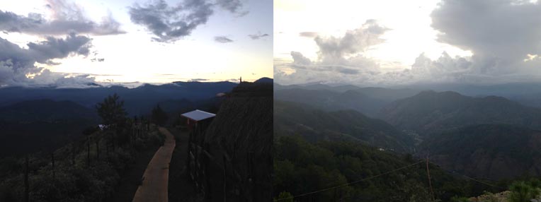
Going down was wonderful because the wide trails looked very similar to the ones in Mt. Ugo. We alternated between running and walking until we reached the concrete part. Here, there was a quick viewdeck of Mt. Pulag as well as the majestic sunset. We couldn’t resist taking pictures.
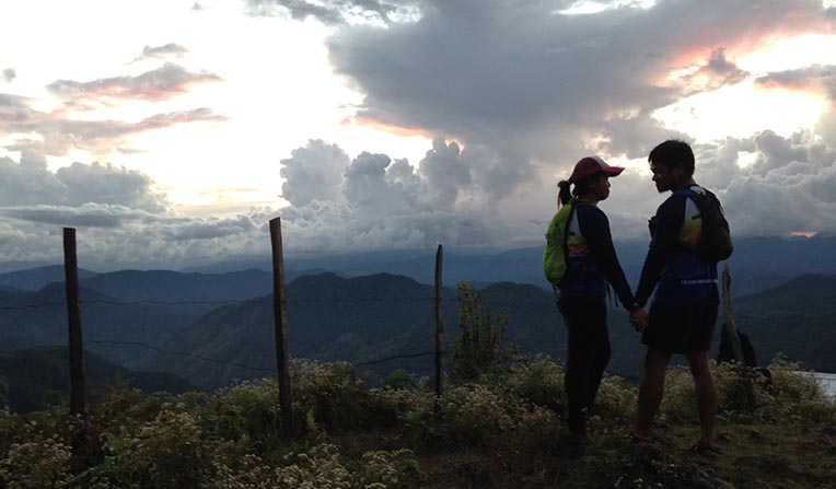
As the last light of day disappeared, our descents started to get more miserable. Going down, the way was paved local trails with slippery moss every now and then. Fumbling around with our lights, we had to go slowly. Finally, after what seemed like an eternity of descending, we made it to the pick up point where we rested while waiting for a local jeepney to take us to the municipal hall where our vans were.
After a short bumpy ride, we arrived at the municipal hall where we fixed up. We had dinner at a nearby eatery before heading back to Manila. Once again I tasted the delicious barako coffee of Benguet that i just can’t seem to get enough of. I still miss it up to this time of writing. But anyway, that’s the Purgatory circuit as I experienced it!
This was a good chill climb literally and spending it with pleasant people definitely made the trip worthwhile.
Thanks to ate Hannah for organizing this one and for always having slots for me. To the familiar faces from Ugo: papi Jim,mam Ruthie, sir Jay, and all the new faces, thank you for the hospitality.
To the komkopols, Abby, Jervis, Tin, and EJ for the companionship and the trail talks as well as the pictures. See you on future trail runs!
To madam Khat for tolerating me throughout the whole trip. I dont know how you do it.
To my fambam for yet again not minding my disappearance
And to the Big Guy for the nice weather conditions. Even if the forecast was rain, thank You for the hike-friendly climate. AMDG.
Benguet is truly a wonderful province filled with endless peaks to go to. And the Purgatory circuit is also a good place for trailrunning training. So I just might return here, but for now, im excited for the other summits I have yet to climb.

Travel safe and happy!
-jgzn

Hello! Nice write-up! I am planning to join an organized Mt. Purgatory day hike and just have a couple of questions. How long did it take you to finish the entire traverse hike? Do you have any idea of the trail length? Thanks in advance!
LikeLike
Hello! Nice write-up! I am planning to join an organized Mt. Purgatory day hike and just have a couple of questions. How long did it take you to finish the entire traverse hike? Do you have any idea of the trail length? Thanks in advance!
LikeLike
Hi! The entire route took about 13 hours overall and the trail length was around 26 to 27 kilometers :) Sorry for the late reply!
LikeLike