 Saturday
October 10, 2015
I’ve been on a quest to finish all four mountains in Sitio Wawa, Montalban (Rodriguez), Rizal. It started with my first successful twin hike to Mts. Pamitinan and Binacayan, and now I’ve finished another, the not-so-gentle giant, Mt. Ayaas!
This climb has been a long time coming. What interests me about Mt. Ayaas is the difference in terrain from its neighbors. After the technical rock-scrambling and shoe-eating boulders of Pamitinan, Binacayan, and even the not-too-distant Sipit-Ulang, the trail of Mt. Ayaas is a friendly variation to reaching the view of the Sierra Madre mountain range.
Mt. Ayaas is also the highest climbable mountain coming from Sitio Wawa and arguably the most difficult mountain in the area. It has a rating of 3/9 on Pinoymountaineer.com, but our guide said that locals give it a 5/9 rating. I don’t think it deserves that high a rating, but it IS more tiring than the others, I’ll give it that.
Getting to Sitio Wawa has become a routine to me, since I have both commuted and biked there before. From Sta. Lucia East Grand Mall, cross the Marcos Highway overpass and ride a Montalban-bound Jeep along Mayor Gil Fernando Avenue. Tell the driver to drop you off at the tricycle station to Wawa. This is also the last stop of the jeep, so no worries. Once you alight, take a trike to Sitio Wawa and boom, climb time!
The first part of the day was literally shitty. I made a mistake of eating a lot of spicy Korean food the night before and I guess it didn’t agree with my stomach. The morning of the climb, I was reaping the benefits which were a stomachache and a bathroom break at the DENR office of Sitio Wawa. We started the trek and I was limping along slowly and farting quietly as we passed through the Wawa Dam.
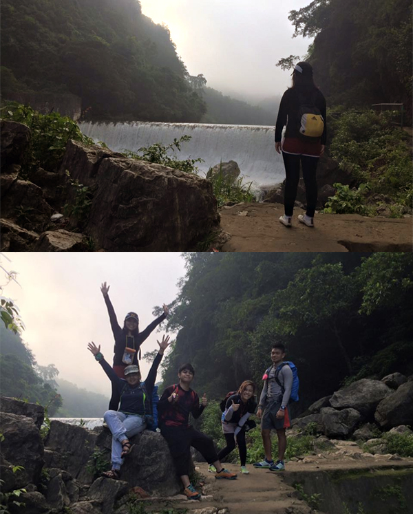
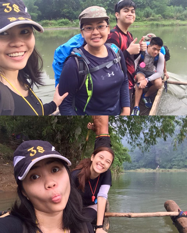
Our guide, kuya Mark, who we met on the trike ride, explained that we had to cross the Wawa river to start the trek. We could ride a boat or we can cross the waist-deep water. Since we weren’t looking to get wet yet, we opted for the boat.
My second mistake was wearing shoes. I got a new pair of trail-running shoes that I wanted to break-in but I didn’t anticipate all this water. They, along with my socks, were wet in no time. I hated getting my socks wet and I trudged along until we reached the first waterfall area where I changed to my slippers.
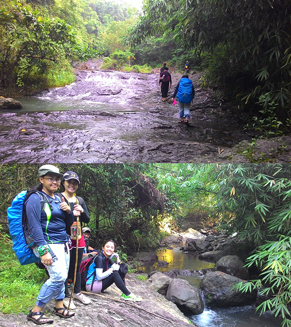
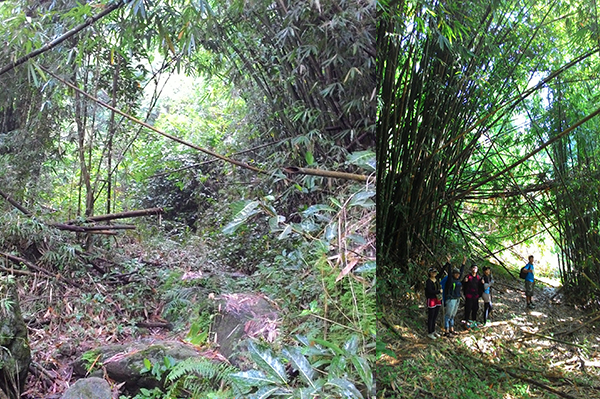
Mt. Ayaas features various terrains up to the summit. The first part was where we followed the river all the way up the mountain. We had lots of river crossings and the water was nice and cool to our feet.
Upon saying goodbye to the river, we reached the part of the trail which was filled with bamboos, somewhat reminiscent of Mt. Palay-palay‘s bamboo forest.
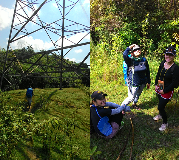
Once we got past that, it was a cool, forest environment. We passed through an electrical tower along the way and I marveled at how heavy machinery used to climb up the mountain just to install these pieces of technology.
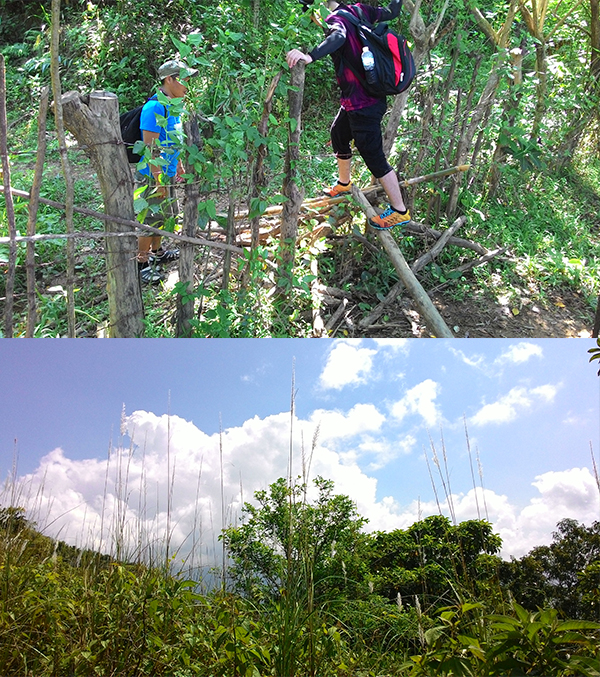
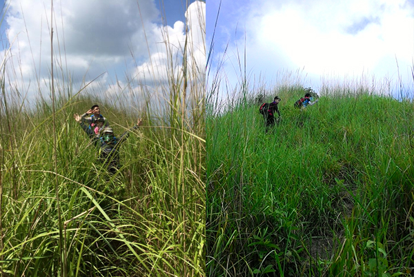
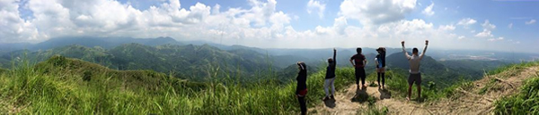
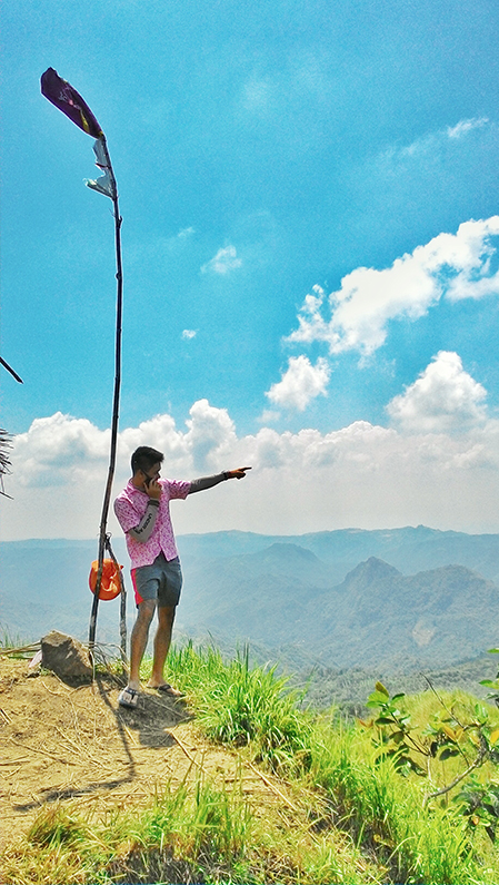
Finally, on the last assault to the summit, it was an open grassland with tall talahib by our sides, reminding me of Mt. Talamitam. From there, we could see the hut that marked the summit and in one final push, we made it.
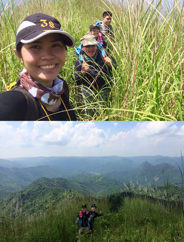
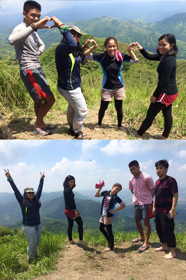
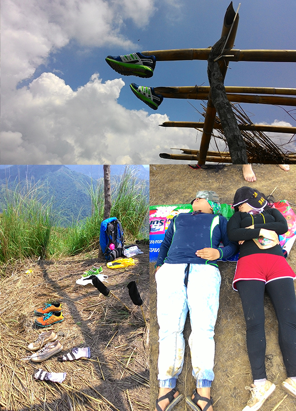
We were the first ones on the hut and we took advantage by eating lunch and sleeping. The other groups arrived by noon time and we had a quick photo session before heading down.

One can choose between a traverse or reverse (back trail) from the summit of Mt. Ayaas. The traverse leads to sitio Mascap, the jump-off of Mt. Sipit-Ulang. Alternatively, one can choose to start the trek from Mascap and end up in Wawa. We chose to go back to Wawa since it was more accessible for all of us.
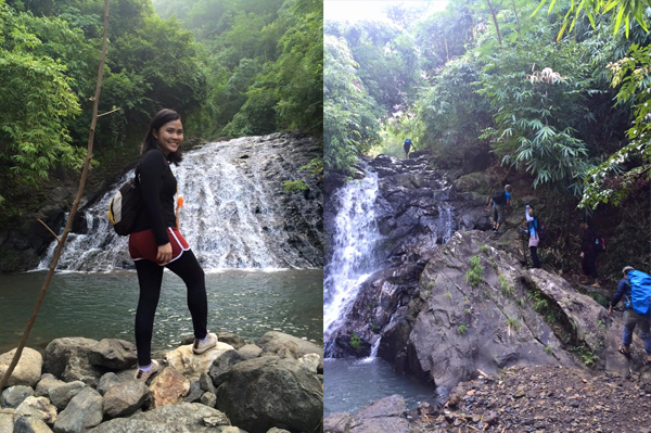
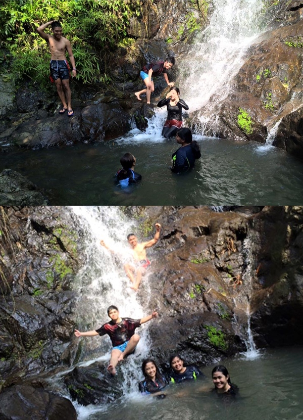
The descent was much quicker, as we were more familiar with the terrain by now. We stopped at a secluded waterfall and refreshed ourselves by swimming in its basin and taking pictures by the cool water.

Finishing our swim, it was more trekking until we returned to the jump-off in Wawa. We ate a lot and fixed ourselves at the local office. After saying goodbye to our guide, we commuted back to the city (where we were welcomed by the traffic) and went our separate ways.
Itinerary and cost breakdown:
(Timekeeping brought to you by rosnof.wordpress.com)
- 04:30 ETD Sta. Lucia Mall, Jeep to Montalban
- P35 per head
- 05:25 ETA Brgy. San Rafael Dulo, Trike to Sitio Wawa
- P10 per head
- 05:47 ETA Sitio Wawa, Register and secure guides
- P50 per head, Ayaas climb fee
- P30 per group, Baranggay donation fee (no minimum and maximum)
- P400 per day, up to 8 people, guide fee (minimum)
- 06:20 Start Trek
- P5 per head, Boat fee (you also pay for the guide)
- 10:40 ETA Summit, Lunch and Photo ops
- 12:35 ETD Summit
- 14:30 ETA Hidden Falls, swim
- 15:15 ETD Hidden Falls
- 16:40 ETA Wawa River
- P5 per head, Boat fee (you also pay for the guide)
- 17:15 ETA Sitio Wawa, Fix up and trike to Eastwood
- P10 per head
- 17:45 ETA Eastwood, Jeep to Cubao
- P30 per head to Santolan LRT Station
- 20:30 ETA Santolan LRT Station
Total Cost: P375
Safe Budget: P600
Tips:
- Be prepared for river trekking. Waterproof your stuff and wear proper footwear.
- Slippers or open sandals are the best for this mountain.
- An average of 4 hours trekking up the mountain, with the last water source at the first hour mark. Bring enough hydration (3L is just enough for me).
- Get set to get wet.
- Bring lots of trail food.
- Unlike the other mountains, Mt. Ayaas has a climb fee of P50 instead of the usual P2 DENR fee because part of the mountain falls under the jurisdiction of the upper Marikina authorities.
You can contact our guide, kuya Mark, at 0912 220 3437. He’s very knowledgeable with the place and has guided pentology climbs before.
This climb wasn’t as heart-pounding or as difficult as I thought, although it was more challenging on my part because of my disobedient stomach. I was farting the whole way up the mountain (good thing I was the sweeper), but thankfully it subsided before it got worse.
Thank you to Rosa, Jo, Rox, and Sy for coming along this climb! They always have a lot of energy to bring to the climb and I’m happy they got to see the beautiful view up in Mt. Ayaas. Big thanks to the Big Guy as well for wonderful climbing weather and for calming the storm in my tummy.
Mt. Ayaas, summit #12, conquered!
-jgzn
p.s.
Just some extra pictures from the climb.

Wow, your adventures are really awesome! I have never tried hiking to the mountains. This must be a thrilling experience. Thank for sharing.
P.S I’m glad your friends didn’t notice your fart. Haha :P
Gly
chasingpotatoes.wordpress.com
LikeLike
Thanks for reading, miss Gly! I never thought I would like climbing mountains, but it gets really addictive! You have to try it for yourself soon! If you have any questions, feel free to shoot me a message :D Travel safe always!
LikeLiked by 1 person
may number po ba kayo ng pwedeng mag guide BRGY.MASCAP na po yata kasi ang jump off gusto sana namen mag river trekking. thanks
LikeLike
Sorry mam, I don’t have a number of the guides in Mascap, but it is possible to get a guide at the brgy hall :)
LikeLike
Is there any place to park my bike near the jump off to Mt Ayaas? I’m thinking of biking there very early in the morning to meet up w/ my fellow hikers. Thanks!
LikeLike
Hello sir, the jumpoff of Mt. Ayaas is now at Sitio Mascap,which is still bikeable but with more uphills. As for a place to park your bike, you can just leave it in the brgy hall, just make sure to tell one of the officials there. :)
LikeLike